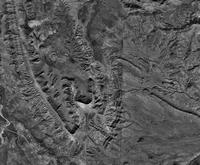
This type of cartography is what was used in early forms of mapping. Basic black and white aerial images where created to map an area with low cost and effort. In the example above, one is able to see a simple overhead black and white view of an area in New Mexico.
http://serc.carleton.edu/research_education/geopad/imagery_data.html
No comments:
Post a Comment