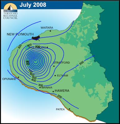
Isohyets are contouring lines that connect areas that have the same rainfall. This type of map can be used to display which locations of a given area receive more or less rainfall than others. In the example above one is able to see that trend of rainfall in near New Plymouth.
http://www.scoop.co.nz/stories/AK0808/S00090.htm
No comments:
Post a Comment