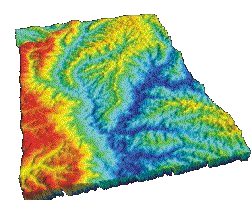
DEM is a digital elevation model of a given location. Here one is able to see a 3D model of the different elevations that a location can have. In the example above one is able to see the different elevations since they are color coded.
http://rrsg.uct.ac.za/activities/activities.html
No comments:
Post a Comment